GeoGuessr turns geography into an active game where every road, sign, building, and landscape can become a clue. Instead of only reading maps, players enter real street scenes and work out where they are. This makes learning geography feel more practical and engaging.

What is GeoGuessr?
GeoGuessr is an online geography game that started in 2013. The main idea is easy to understand. The game places players inside a street-level image somewhere in the world. Then, they must study the area and decide where that place is located.
A location may appear in a large city, a small village, a quiet road, or a remote rural area. Therefore, players cannot always depend on famous landmarks. Small details often become more useful.
For example, a road sign may show a local language. Road lines can suggest a certain country. Utility poles may have a special shape. Houses, trees, soil, mountains, and even the direction of the sun can also help.
The basic process works like this:
Street-Level Image
        ↓
Study Visible Clues
        ↓
Compare Country Features
        ↓
Choose a Place on the Map
        ↓
Submit the Guess
Each round gives points based on the distance between the guess and the real location. A very accurate guess can earn up to 5,000 points in one round.
However, a guess that lands far away receives a lower score. Because of this system, players need both country knowledge and careful map placement.
Over time, the platform has grown far beyond its original format. Players can now enjoy solo modes, ranked games, community maps, mobile play, and major competitive events.
As a result, the game supports many different skill levels. A new player can learn basic countries, while an experienced player can study tiny road and camera details.
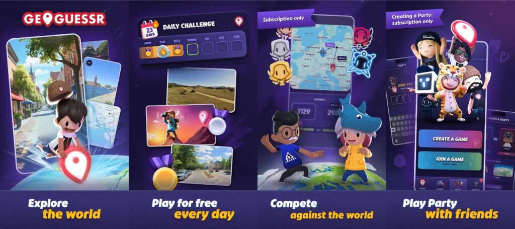
GeoGuessr Features
GeoGuessr includes several game modes for different types of players. Some modes focus on learning and practice. Others focus on fast competition.
The platform also allows players to explore special maps made around countries, cities, landmarks, road types, and other themes. Therefore, the experience can change a lot from one map to another.
Classic Singleplayer & Daily Challenge
Single-player modes give players more control over the pace of each game. They work well for learning because there is less pressure from another player.
Classic Mode: Players choose a map and complete several location rounds. Common maps may focus on the whole world, one country, famous places, or other selected areas.
Each round gives time to inspect the scene, gather clues, and place a map marker. This makes Classic Mode useful for learning new visual patterns.
For example, a player may notice that one country uses certain road signs. Later, the same sign can help solve another round.
Daily Challenge: This mode gives players the same set of locations for that day. Therefore, scores can be compared more fairly.
The Daily Challenge also creates a simple routine for regular players. One short game each day can help improve visual memory and country knowledge over time.
Country Streaks: This mode focuses on identifying the correct country. Players continue as long as they keep choosing the right country.
A single wrong answer ends the streak. Because of that rule, players must balance confidence with careful thinking.
Competitive Multiplayer & Duels
Competitive play adds more pressure because another player is trying to solve the same locations.
In Duels, two players face each other across several rounds. Both sides study the same location and submit a guess.
The game then compares each result. A better guess can reduce the other player’s health based on the score difference.
Later rounds may use stronger damage multipliers. Therefore, one accurate guess can change the result of a close match.
Competitive divisions give players a ranked path. Progress depends on performance against other players.
Different rule types can also change how much information is available.
Move: Players can travel along available roads. They can also turn the camera, look around, and zoom.
This mode gives the most freedom. It also allows players to search for signs, town names, road numbers, and business information.
No Move (NM): Players cannot travel away from the starting point. However, they can still turn the view and zoom.
This mode depends more on visible clues near the original location.
No Move, Pan, Zoom (NMPZ): Players receive a fixed view. They cannot move, turn the camera, or zoom.
As a result, every visible detail matters. Road texture, plants, poles, camera quality, shadows, and buildings may all become important.
Custom Maps & Map Maker
Community maps add a large amount of extra content.
Players can create maps around a specific theme. For example, a map may focus on capitals, islands, mountains, small towns, national parks, or one type of road.
Some creators build easier maps for beginners. Meanwhile, others make difficult maps for experienced players.
The Map Maker also lets creators choose locations for special challenges. This gives teachers, groups, and communities more control over what appears during a game.
For example, a teacher could build a map around major European cities. Another creator could make a map focused only on unusual rural roads.
Because community maps can use narrow themes, they are also useful for training. Players can practise one type of clue instead of studying the entire world at once.
Mobile & Cross-Platform Integration
GeoGuessr can be played through supported web and mobile options.
The mobile version gives players a touch-based way to explore locations and place guesses. This can work well for quick games away from a desktop computer.
Meanwhile, browser play gives players a larger screen and easier map control. A bigger display can also make small signs and road details easier to inspect.
Account-based progress can help players continue using the same profile across supported platforms. Therefore, players do not always need to start from the beginning when changing devices.
A stable internet connection is important because street-level images and map data must load during play.
How To Install GeoGuessr on LDPlayer
LDPlayer allows Android apps to run inside a Windows computer. Some players may prefer this method because it gives them access to the mobile app interface on a larger display.
Before starting, make sure the computer has enough free storage and a stable internet connection.
Follow these steps in order.
Step 1: Download and Install LDPlayer
Visit the official LDPlayer website and download LDPlayer 9.
Open the installer after the download finishes. Then, follow the setup instructions shown on the screen.
Choose the installation location if needed. After that, complete the installation.
Step 2: Launch the Emulator
Open LDPlayer from the desktop shortcut or Start menu.
The first launch may take a little longer because the emulator needs to prepare its Android system.
Wait until the main Android home screen appears.
Step 3: Access Google Play Store
Find the Google Play Store inside LDPlayer.
Open it and sign in with a Google Account. A valid account is needed to install apps from Google Play.
If Google asks for security checks, complete them before moving forward.
Step 4: Search for the App
Click the search box inside Google Play.
Type GeoGuessr and start the search.
Check the app name and developer information before installing. This helps avoid unofficial copies with similar names.
Step 5: Install the Application
Open the correct app page.
Click Install and allow Google Play to download the required files.
The installation speed will depend on the internet connection and computer performance.
Once installation finishes, an app icon should appear inside LDPlayer.
Step 6: Open the Game
Click the app icon to launch it.
Sign in or create an account when required.
After login, allow the main menu and game content to load fully.
Step 7: Configure Keyboard and Mouse Mapping
LDPlayer includes keyboard mapping tools on its side menu.
Open the keymapping controls and assign useful keyboard buttons where needed.
For example, movement controls can be linked to familiar keys. Mouse clicks can still handle menus, map placement, zoom controls, and other actions.
Test the controls in a normal game before entering a competitive match.
How To Play GeoGuessr
GeoGuessr becomes easier when clues are checked in a clear order.
Random guessing may work sometimes, but a simple system gives better results. Start with large clues before studying very small details.
A useful order looks like this:
1. Check road and driving side
2. Look for language
3. Study road signs
4. Inspect buildings and poles
5. Check plants, land, and weather
6. Use the map to narrow the area
7. Place the final guess
Road Signs & Language
Road signs often give some of the strongest location clues.
First, look for readable words. A town name, road number, company name, or direction sign can quickly reduce the number of possible countries.
The alphabet also matters. Greek letters look different from Latin letters. Cyrillic text can suggest several countries in Eastern Europe and nearby regions.
Other areas may use Arabic, Thai, Japanese, Korean, or other writing systems.
However, language alone does not always give a full answer. Several countries may use the same language.
Therefore, combine text with road design, signs, buildings, and other clues.
Small marks above or below letters can also help. Certain languages use special characters more often than others.
Driving Direction & License Plates
The side of the road used by traffic can remove many possible countries.
Watch moving cars when traffic is visible. Parked cars can also help, but they are less reliable because they may face either direction.
Road signs can provide another clue. Their position may show which side drivers normally use.
Next, inspect license plates if they are clear enough to see.
Plate color, size, and side markings may support a country guess. However, image blur can hide some details.
For that reason, license plates work best as supporting evidence rather than the only clue.
Utility Poles & Infrastructure
Utility poles may look normal at first. Still, experienced players often use them because countries build poles in different ways.
Check the pole material. It may use wood, concrete, or metal.
Then, look at the shape. Some poles include holes, stripes, special tops, transformers, or unusual wire layouts.
Roadside posts and bollards can also help. Their colors and reflector shapes often follow national road standards.
Guardrails, road drains, curbs, fences, and pavement styles provide more information.
These details become especially useful when no readable signs appear.
Sun Position & Environment
The natural environment can help narrow the location.
Start with the landscape. Check whether the area looks dry, tropical, snowy, flat, coastal, forested, or mountainous.
Then, study plant types. Palm trees may suggest a warm climate. Pine forests can suggest cooler or higher areas.
Soil can also provide clues. Some regions have strong red soil, pale sand, dark volcanic ground, or dry brown land.
The sun can help with hemisphere estimates. In general, its position may suggest whether the location sits north or south of the equator.
However, the time of day and season can make this clue harder to use. Therefore, the sun should not replace stronger evidence.
Once enough clues have been collected, open the map.
Start by choosing the most likely country. Then, narrow the search to a region, city, or road.
Finally, place the marker and submit the guess.
Safety and Legality
Playing GeoGuessr should involve normal online safety habits.
Account details should stay private. Use a strong password, and avoid sharing login information with other people.
Players should also check that they use official apps and trusted software. Unofficial downloads can include unwanted programs or unsafe files.
When using LDPlayer, download the emulator from its official source. Likewise, install the game through a trusted app store.
Third-party cheating tools should be avoided.
Scripts, automated solvers, hidden location tools, and other unfair methods can damage competitive play. They may also break platform rules.
Players should also respect other users during multiplayer games and community activity.
Do not share private details through usernames, profiles, or public messages. Younger users should follow normal family and account safety rules.
Street-level images may show homes, roads, businesses, and public areas. These images are part of the map experience and should be treated as location clues, not as a reason to target private individuals.
GeoGuessr FAQ
Is GeoGuessr completely free to play?
GeoGuessr may provide access to selected game options without requiring the same level of access as paid plans.
However, available features can depend on the current platform and account type.
Paid access may include more gameplay options, competitive features, and other account benefits.
Players should check the options shown inside the official service before choosing a plan.
Can GeoGuessr be played on PC without an emulator?
Yes. The game can be played on a computer without using an Android emulator.
A supported web browser provides a direct way to play on PC.
LDPlayer is mainly useful for people who want to run the Android version inside Windows.
Therefore, an emulator is an optional method rather than a basic requirement.
Does GeoGuessr help improve geography skills?
Yes, regular play can support several useful geography skills.
Players learn to notice countries, languages, road systems, landscapes, climate zones, flags, cities, and regional features.
It also trains observation.
For example, a player may begin by noticing only large signs. After more practice, smaller clues such as bollards, poles, road lines, roofs, and plants become easier to remember.
The game can also encourage players to learn why different parts of the world look the way they do.
What are Move, No Move, and NMPZ modes?
Move allows players to travel through available street imagery. They can also turn the camera and zoom.
No Move keeps players at the starting position. However, camera turning and zooming remain available.
NMPZ means No Move, Pan, or Zoom. Players must solve the round from the exact image shown at the start.
Because NMPZ gives very little control, it usually requires stronger visual knowledge.
Final Words
GeoGuessr gives players a simple way to explore the world while testing geography knowledge.
Every round can teach something new. One location may depend on a road sign. Another may require attention to plants, driving direction, buildings, or utility poles.
Beginners can start with easier maps and use Move mode. Then, they can slowly learn country clues and improve map accuracy.
More experienced players can try streaks, Duels, No Move, or NMPZ matches. These modes require faster thinking and stronger clue recognition.
Playing on a browser is the simplest PC option. However, LDPlayer gives another choice for players who prefer the Android app interface on Windows.
Above all, steady practice matters more than memorizing every clue at once. Study one detail, compare it with the full scene, and make a careful guess.
With regular practice, GeoGuessr can make world geography easier to understand while keeping each new location fresh and challenging.